Biri Island, Philippines
Biri is a small island municipality at the northern tip of Northern Samar, in the Eastern Visayas, with the Pacific Ocean to the east and the San Bernardino Strait to the west. More about Biri Island →
Cruise Ships in Biri Island
Next call · all times local (Philippine Standard Time)

Showing 1 upcoming call
Getting to the Biri Island cruise port
Lavezares Port (mainland Samar) → Biri Port
16.6 km · ~60 min by car
Public boat from Lavezares Port on mainland Samar to Biri, about 1 hour. Lavezares is about 1 hour by minibus from the Catarman Land Transport Terminal. The distance is approximate, measured in a straight line.
Typical prices, approximate. Fares change with demand, traffic and time of day.
Typical prices, approximate. Fares change with demand, traffic and time of day.
Driving to the port
The public boat is for independent travel; cruise passengers should follow the ship's shore arrangements.
Eating in Biri Island
Places to eat are in Biri town near the port.
About Biri Island
Biri is a small island municipality at the northern tip of Northern Samar, in the Eastern Visayas, with the Pacific Ocean to the east and the San Bernardino Strait to the west.
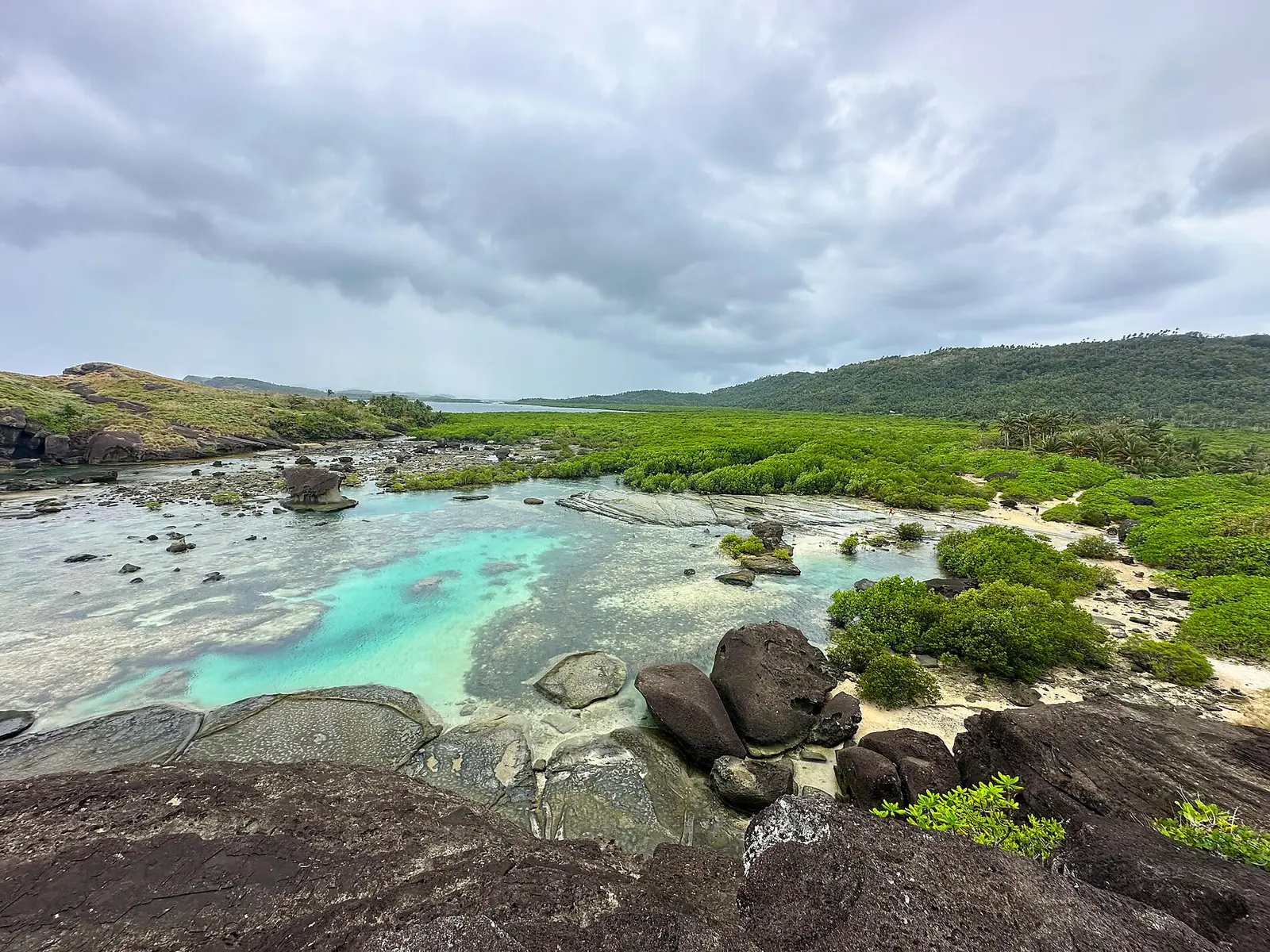
It is known for the Biri Rock Formations, seven large rock outcrops including Magasang, Magsapad, Macadlaw and Bel-at, now a national geological monument within the Biri-Larosa Protected Landscape and Seascape.
Visitors walk through mangroves to viewpoints over the rocks, swim in the Bel-at tidal pool between them, and watch the sunset from Busay Hill. Fishing villages dry danggit, the local rabbitfish, and the reefs suit snorkelling and diving. How passengers come ashore can vary, so check with your ship.
- Climate
- Hot, humid tropical climate with heavy rain all year and no real dry season. Based on long-term averages at the Catarman weather station, about 34 km from the port, mean maximums range from about 29 C in January to about 33 C in May, and mean minimums from about 22 to 24 C. Rain totals about 3,750 mm a year on some 186 days. November to January are the wettest months, with about 690 mm in December; April and May are the least wet, at about 150 to 165 mm a month. All figures are approximate.
- Time zone
- Philippine Standard Time
- Currency
- Philippine peso (PHP)