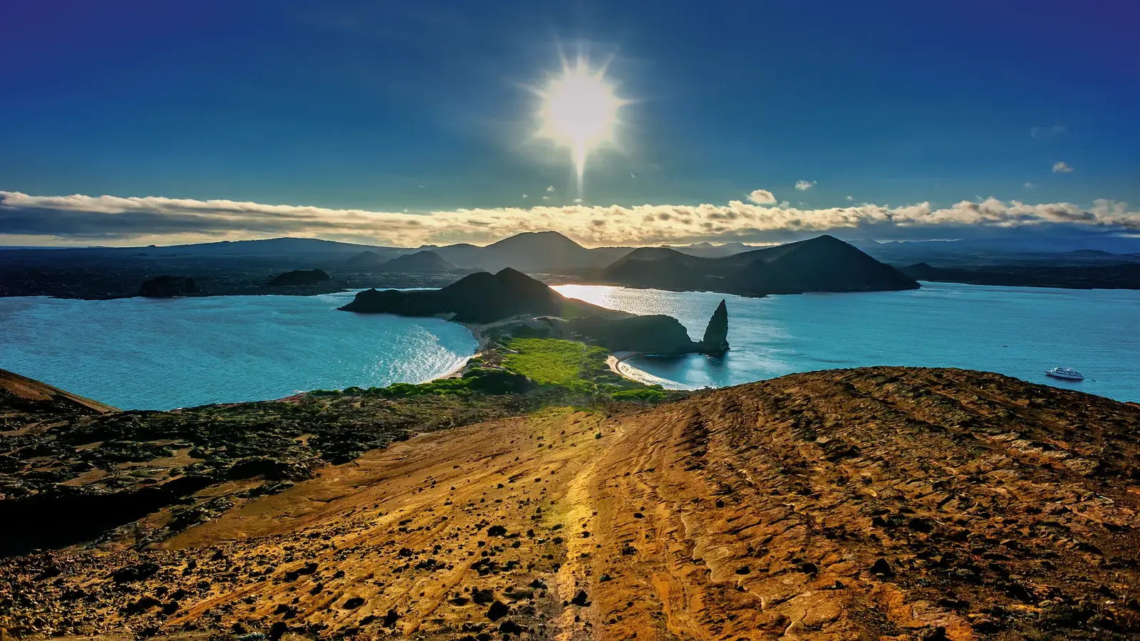
Bartolome Island, Galapagos
Bartolome is a small, uninhabited volcanic islet of about 1.2 square km in Sullivan Bay, just off the east coast of Santiago in the centre of the Galapagos archipelago. More about Bartolome Island →
Cruise Ships in Bartolome Island
No ships are scheduled in Bartolome Island yet
New calls appear here as cruise lines publish them.
Where is the Bartolome Island cruise port?
There is no harbour, town or services. Guests go ashore in small boats with a National Park naturalist guide.
For the summit walk, the boat lands guests at a small landing on the rocks (a dry landing), and a boardwalk and stairway of about 370 steps climbs some 600 m to the viewpoint. Pinnacle Rock beach, on the north side, is reached by a wet landing onto the sand for swimming and snorkelling. Visits follow fixed Park trails and times and depend on sea conditions.
About Bartolome Island
Bartolome is a small, uninhabited volcanic islet of about 1.2 square km in Sullivan Bay, just off the east coast of Santiago in the centre of the Galapagos archipelago. It is named after Sir Bartholomew James Sulivan, a friend of Charles Darwin and second lieutenant on HMS Beagle.
The trail to the top crosses a barren landscape of spatter cones, tuff cones and lava flows. From the 114 m summit, the view over two curving bays, a narrow isthmus and the volcanic spire of Pinnacle Rock is one of the best-known scenes in Galapagos.
Galapagos penguins, sea lions and marine life live around Pinnacle Rock, and green turtles nest on the north beach. Bartolome is a protected Galapagos National Park visitor site, visited only with a Park-certified naturalist guide.
- Climate
- Dry, sunny equatorial climate, cooled by ocean currents, with two seasons. From January to May the warm season brings hot, humid days and occasional heavy showers: long-term averages for Puerto Ayora, the nearest long-term station, give highs of about 29-31 C, lows of about 23 C, and a sea of about 25 C. From June to December the cooler garua season brings stronger winds, more cloud, light drizzle and a cooler sea: highs of about 24-27 C, lows of about 20 C, and a sea of about 21-23 C. Rainfall is low, about 440 mm a year at Puerto Ayora, and the lowlands of the islands are the driest parts. El Nino years can be much hotter and wetter. All figures are approximate.
- Time zone
- Galapagos Time
- Currency
- US Dollar (USD)